Wyniki wyszukiwania
Op Zoek Naar Harmonie : schaakproblemen / van Gerard Johan Bouma ; geselecteerd door den componist en toegelicht door Dr. M. Niemeijer.

- Katalog: Biblioteka szachowa
- Autor: Bouma, Gerard Johan (1923-).
- Rok wydania: 1984.
- Sygnatura: Sz 20440
Tijdschrift van den Koninklijken Nederlandschen Schaakbond.
- Katalog: Biblioteka szachowa
- Rok wydania: 1939.
- Sygnatura: Sz 20441 Cz
Szachista : miesięcznik poświęcony grze i studjom szachowym / [red. Henryk Friedman].
- Katalog: Biblioteka szachowa
- Rok wydania: 1933-1935.
- Sygnatura: Sz 20442 Cz.
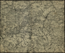
[Mapa Wielkopolski
- Katalog: Kartografia
- Data wydania: 1900 ca]
- Sygnatura: M II 304
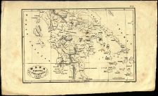
Plan of Otchakov, as it was when besieged by the Turks under the Seraskir Ali Pasha et the Khan of the Crimea. Copied from an old published Map
- Katalog: Kartografia
- Data wydania: 1855
- Sygnatura: A V 026
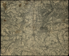
[Mapa Wielkopolski
- Katalog: Kartografia
- Data wydania: 1900 ca]
- Sygnatura: M II 305
A Plan of the Bay et Fortification of Eupatoria
- Katalog: Kartografia
- Data wydania: 1855
- Sygnatura: A V 026
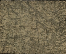
[Mapa Wielkopolski
- Katalog: Kartografia
- Data wydania: 1900 ca]
- Sygnatura: M II 306
Theodosia or Kafa Crimea.
- Katalog: Kartografia
- Data wydania: 1855
- Sygnatura: A V 026
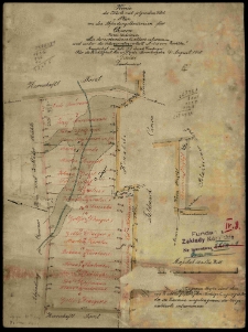
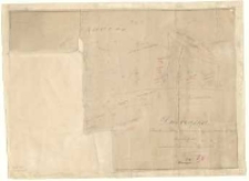
Obr[ęb] Czołowo [...] /
- Katalog: Kartografia
- Data wydania: 1905
- Sygnatura: M I 097
Mappa części odciętej koleją od folwarku Dachowy /
- Katalog: Kartografia
- Data wydania: 1879
- Sygnatura: M I 098
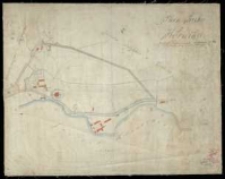
Kopie der Karte mit folgendem Titel: Plan von den Abfindungsländereien für Czmon Kreis Schrimm
- Katalog: Kartografia
- Data wydania: 1910
- Sygnatura: M I 102
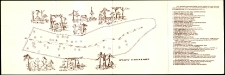
Żolibor i w nim konkwikt xięży piiarów założony przez Stanisława Konarskiego S. P. przy Miodowey ulicy r. 1744 przeniesiony w to przyiemne mieysce r. 1807.
- Katalog: Kartografia
- Data wydania: 1822
- Sygnatura: M II 161
Auszug aus der Karte mit dem Titel. Karte von Czolowo Schrimmer Kreises /
- Katalog: Kartografia
- Data wydania: 1913
- Sygnatura: M II 172
Plan and Section of the Lines of Perekop, from an old Published Plan (1736), Communicated by Mr. Derham.
- Katalog: Kartografia
- Data wydania: 1855
- Sygnatura: A V 026
Bay of Alushta, Crimea, from the Survey
- Katalog: Kartografia
- Data wydania: 1855
- Sygnatura: A V 026
Dworzyska :
- Katalog: Kartografia
- Data wydania: 1896
- Sygnatura: M III 393
Brouillon Karte von dem im Szrimschen Kreise belegenen adelichen Guthe Gądki /
- Katalog: Kartografia
- Data wydania: 1821
- Sygnatura: M III 404
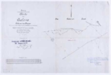
Karte von dem zu Trzebaw gehoerigen Wiesen-Terrain Kierszki bei Alt-Dymaczewo, Kreis Posen /
- Katalog: Kartografia
- Data wydania: 1866
- Sygnatura: M III 408
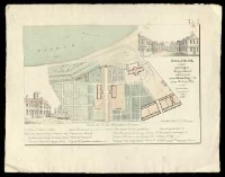
Plan parku w Kórniku /
- Katalog: Kartografia
- Data wydania: 1879
- Sygnatura: M III 530


Wyświetlono rekordy 1-20 z 152