Wyniki wyszukiwania
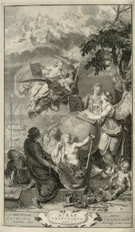
Atlas historique, ou Nouvelle introduction a l'histoire, à la chronologie et à la geographie ancienne et moderne
- Katalog: Kartografia
- Data wydania: 1732.
- Sygnatura: A IV 022/6
Suplement a L'atlas historique, contenant diverses pieces de chronologie, de genealogie, d'historie et d'autres sciences, qui avoient e'te' omises dans les precedens volumes.
- Katalog: Kartografia
- Data wydania: 1732.
- Sygnatura: A IV 022/7
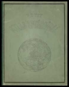
Nouvel atlas spheroidal a l'usage des ecoles primaires
- Katalog: Kartografia
- Data wydania: [1876]
- Sygnatura: A IV 026
Atlas de geographie contenant neuf cartes coloriees, savoir: N. 1. Mappemonde. N. 2. Mappemonde, emblematique. N. 3. Europe N. 4. Europe, emblematique. N. 5. Europe centrale N. 6. Europe centrale, emblem. N. 7. Asie. N. 8. Amerique. N. 9. Afrique {1. Afrique. 2. Etats-Unis. 3. Iles Britanniques. 4. Espagne et Portugal. /
- Katalog: Kartografia
- Data wydania: [1850 ca]
- Sygnatura: A IV 030
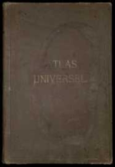
Atlas universel de geographie moderne /
- Katalog: Kartografia
- Data wydania: [1853]
- Sygnatura: A IV 035
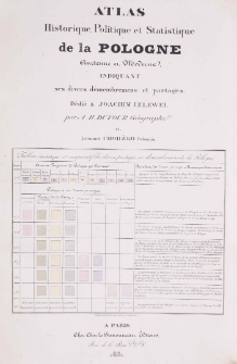
Atlas historique, politique et statistique de la Pologne ancienne et moderne, indiquant ses divers demembremens et partages.
- Katalog: Kartografia
- Data wydania: 1831
- Sygnatura: A IV 037
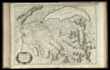
Partie Septentrnale des Estats de Savoye ou sont les Duches de Genevois, de Chablais et le Faussigny. &c.
- Katalog: Kartografia
- Data wydania: 1663
- Sygnatura: A IV 062/70
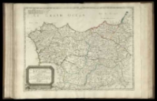
Les Estats De La Couronne de Castille,
- Katalog: Kartografia
- Data wydania: 1679
- Sygnatura: A IV 062/64
Partage de la Pologne.

- Katalog: Kartografia
- Data wydania: 1815 po]
- Sygnatura: A IV 046
[Claudii Ptolemaei tabulae geographicae orbis terrarum veteribus cogniti].
- Katalog: Kartografia
- Data wydania: 1695]
- Sygnatura: A IV 054
[Der große Weltatlas der Deutschen Buch - Gemeinschaft.
- Katalog: Kartografia
- Data wydania: 1929
- Sygnatura: A IV 095
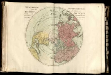
Planisphere terrestre ou sont marquees les Longitudes de divers Lieux de la Terre, trouvees par les observations des Eclipses des Satellites de Iupiter. Dresse et Presente a S A majeste /
- Katalog: Kartografia
- Data wydania: 1696
- Sygnatura: A IV 015/I,5
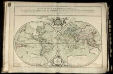
Mappe-monde geo-hydrographique, ou description generale du globe terrestre et aquatique, en deux plans-hemispheres, ou sont exactement remarquuees en general toutes les parties de la terre et de l'eau, suivant les relations les plus nouvelles. /
- Katalog: Kartografia
- Data wydania: 1706.
- Sygnatura: A IV 015/I,2
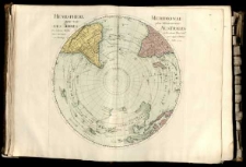
Hemisphere septentrional pour voir plus distinctement les Terres Arctiques. /
- Katalog: Kartografia
- Data wydania: 1714
- Sygnatura: A IV 015/I,6
Rossijskoj atlas iz soroka četyrech kart sostojaščij i na sorok na dva namestnicestva imperiju razdlejajuščij
- Katalog: Kartografia
- Data wydania: 1792
- Sygnatura: A V 012
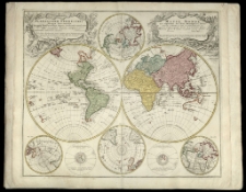
Atlas Novus Sive Tabulae Geographicae Totius Orbis Faciem, Partes, Imperia, Regna et Provincias exhibentes :
- Katalog: Kartografia
- Data wydania: [ca 1730].
- Sygnatura: A V 015
Atlas minor XXXVI tabularvm Homannianarvm
- Katalog: Kartografia
- Data wydania: [1737 po]
- Sygnatura: A V 020
Atlas Silesiae id est Dvcatvs Silesiae generaliter quatuor mappis nec non specialiter XVII mappis tot principatvs repraesentantibvs geographice exhibitvs
- Katalog: Kartografia
- Data wydania: 1750 [rz., i.e. 1752]
- Sygnatura: A V 021
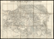
Karte von Georgien, Armenien und Kurdistan.
- Katalog: Kartografia
- Data wydania: 1854
- Sygnatura: A I 014
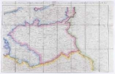
Neue militarische Situations- und Post-Carte von Polen und Preussen /
- Katalog: Kartografia
- Data wydania: 1812
- Sygnatura: A I 015

Wyświetlono rekordy 1-20 z 3325