Search Results
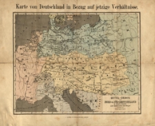
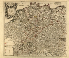
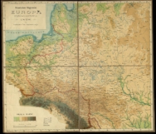
Mittel-Europa oder Nord- u. Süd-Deutschland in seiner Zukunft nach diplomatischen Aufstellungen bearb. von William Bilsy.
- Library catalog: Maps
- Creation date : [1850 ca]
- ID: M III 295
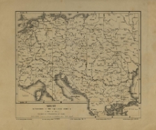
Europa. [Mapa polityczna].
- Library catalog: Maps
- Creation date : 1910 ca]
- ID: M III 277
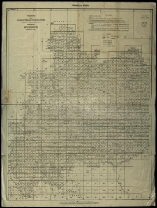
Skelett der Übersichtskarte von Mittel-Europa im Masse 1:750 000 d. N. N.
- Library catalog: Maps
- Creation date : [1900 ca]
- ID: M II 154
Übersicht der vom Reichsamt für Landesaufnahme Berlin im Masstabe 1:25 000 der natürlichen Länge veröffentlichen Messtischblätter (Stand: Februar 1933)
- Library catalog: Maps
- Creation date : 1933
- ID: M IV 100
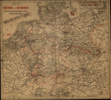
Karte der Bäder und Kurorte Deutschland, Oesterreich Ungarns, der Schweiz und angrezenden Ländern.
- Library catalog: Maps
- Creation date : [1900 ca]
- ID: M III 009
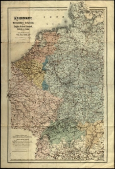
Kriegskarte von Westdeutschland, OstFrankreich, nebst Belgien, Holland, Dänemark, Schweiz und Italien [...]. Gezeichnet v. Rudolf Gross.
- Library catalog: Maps
- Creation date : [1875 ca]
- ID: M III 620
Allemagne par religions ou l'on diszingue les provinces catholiques, lutheriennes et calvinistes. Par [...] Le Rouge.
- Library catalog: Maps
- Creation date : [1850 ca]
- ID: M III 282
Staats und Verwaltungsgrenzen in Ostmitteleuropa historisches Kartenwerks.

- Library catalog: Maps
- Creation date : 1954
- ID: A III 108
Staats und Verwaltungsgrenzen in Ostmitteleuropa historisches Kartenwerks
- Library catalog: Maps
- Creation date : 1954
- ID: A III 108
Staats und Verwaltungsgrenzen in Ostmitteleuropa historisches Kartenwerks
- Library catalog: Maps
- Creation date : 1954
- ID: A III 108
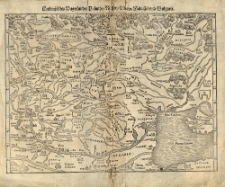
Landtafel des Ungerlands, Polands, Rüssen, Littan, Walachei und Bulgarei. [Sebastian Münster].
- Library catalog: Maps
- Creation date : 1550 ca]
- ID: M II 122
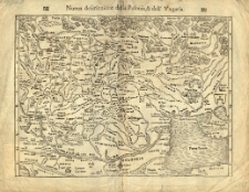
Nouva descrizzione della Polonia et dell' Ungaria. [Sebastian Münster].
- Library catalog: Maps
- Creation date : 1550 ca]
- ID: M II 113
Dritter Theil der Karte von Europa welcher das südliche Russland, Polen und Ungarn die europaeische und beinahe die ganze asiatische Türkei enthaelt. Verfasst von [Jean Baptiste] d'Anville. Neu hrsg. von F. A. Schraembl.
- Library catalog: Maps
- Creation date : 1788
- ID: M IV 082
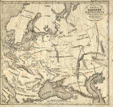
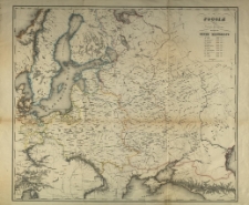
Karte der Länder und Völker des Kaiserthums Russland [...].
- Library catalog: Maps
- Creation date : 1917 po]
- ID: M II 010
Stanisław Majerski: Europa środkowo-wschodnia.
- Library catalog: Maps
- Creation date : [1890 ca]
- ID: M III 787
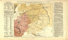
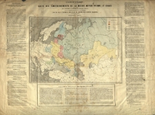
Carte ethnographique de la Russie et des contrees environnantes an IX-e siècle.
- Library catalog: Maps
- Creation date : 1819
- ID: M III 128
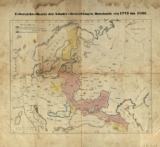
Uebersichts-Karte der Länder-Erwerbungen Russlands von 1772 bis 1829.
- Library catalog: Maps
- Creation date : 1829 po]
- ID: M III 133
Panowanie narodów słowiańskich od Wołgi aż do Elby i Sali od wieku VI do IX po Chrystusie /
- Library catalog: Maps
- Creation date : 1829 ca]
- ID: M III 192
Carte des agrandissements de la Russie depuis Pierre le Grand jusqu'a ce jour. Publie par J. Correard.
- Library catalog: Maps
- Creation date : 1854
- ID: M III 083
Rossija z 1700 do 1707 goda. Pochody Petra Velikago.
- Library catalog: Maps
- Creation date : 1900 ca]
- ID: M III 100


Viewed records 2081-2100 from 3325