Search Results
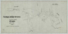
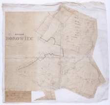
Fundacja Zakłady Kórnickie. Plan gruntów w gromadzie Borowiec, powiat Śrem [...] Sporządzone w r. 1946 na podstawie mapy katastralnej /
- Library catalog: Maps
- Creation date : 1946
- ID: M II 231
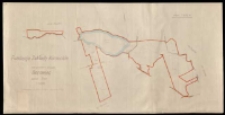
Fundacja Zakłady Kórnickie. Plan gruntów w gromadzie Borówiec powiat Śrem [...] Sporządzono w r. 1946 na podstawie mapy katastralnej /
- Library catalog: Maps
- Creation date : 1946
- ID: M II 208
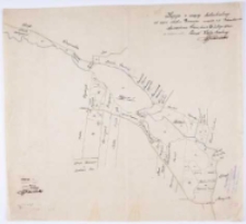
Plan von den Abfindungs Ländereien für einige Wirthe aus Borowcer-Hauland Kreises Schrimm /
- Library catalog: Maps
- Creation date : 1841
- ID: M III 396
Hauland Borowiec im Schrimmer Kreise /
- Library catalog: Maps
- Creation date : 1837
- ID: M IV 140
Kopja z mapy katastralnej od częsci obrębu Borówiec mapa 1 i 2 [...] /
- Library catalog: Maps
- Creation date : 1924 ca]
- ID: M III 478
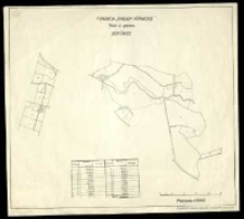
Fundacja "Zakłady Kórnickie". Role w gminie Borówiec /
- Library catalog: Maps
- Creation date : 1925 ca]
- ID: M III 547
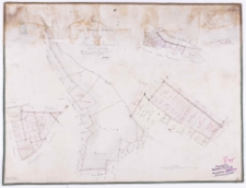
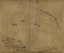
Wygotowany przez Kunduktora Żurkew (?) Dnia 25/ej 55. Czołowo 23 Lipca 73 przy [nieczyt.] Framku Rakocky (?) Agronom org [nieczyt.] z polem.
- Library catalog: Maps
- Creation date : 1873
- ID: M II 295
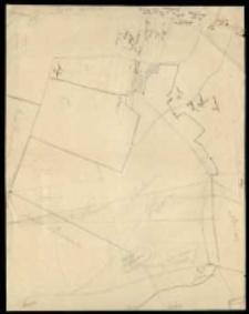
[Rękopiśmienny szkic, na którym zaznaczono nazwiska właścicieli gruntów położonych w rewirze Czołowskim].
- Library catalog: Maps
- Creation date : 1850 ca]
- ID: M III 731
Plan von dem Abfindungs Lande für die Wirthe F. Andrzeiewski u[nd] B. Kochliński zu Zwolner Hauland /
- Library catalog: Maps
- Creation date : 1843
- ID: M I 146
Charte von Żymin Schrodaer Kreises /
- Library catalog: Maps
- Creation date : 1827
- ID: M IV 126
Plan parcelacyjny maj. Radzewo pow. Śrem [...] Własność Marji Gorgolińskiej i Heleny Ganowiczowej [...] /
- Library catalog: Maps
- Creation date : 1935
- ID: M II 300
Ortsplan Stadt Burgstadt Kr[ei]s Schrimm.
- Library catalog: Maps
- Creation date : 1942
- ID: M IV 346
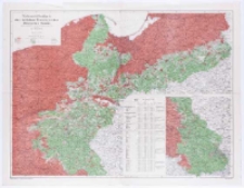
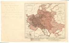
Nationalitätenkarte der östlichen Provinzen des Deutschen Reichs nach den Ergebnissen der amtlichen Volkszählung vom Jahre 1910 /
- Library catalog: Maps
- Creation date : 1910
- ID: M III 228
Pologne et ses pays limitrophes /
- Library catalog: Maps
- Creation date : 1919 ca]
- ID: M III 229
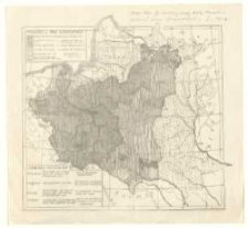
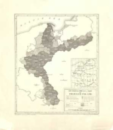
[Podziały Polski] /
- Library catalog: Maps
- Creation date : 1917]
- ID: M III 230
Ethnographical Map of Prussian Poland /
- Library catalog: Maps
- Creation date : [1919]
- ID: M III 231
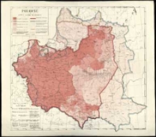
Pologne et pays limitrophes /
- Library catalog: Maps
- Creation date : [1919 ca]
- ID: M III 233
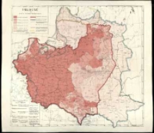
Pologne et pays limitrophes /
- Library catalog: Maps
- Creation date : [1919 ca]
- ID: M III 234
Pologne et pays limitrophes /
- Library catalog: Maps
- Creation date : [1919 ca]
- ID: M III 235
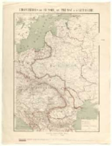
Frontières de Russie, de Prusse et d'Autriche /
- Library catalog: Maps
- Creation date : [1894 ante].
- ID: M III 236


Viewed records 2241-2260 from 3325