Search Results
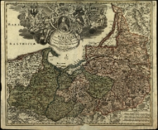
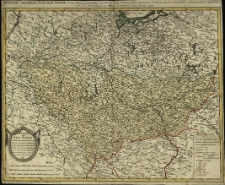
Regnum Borussiae [...] geographice cum vicinis regionibus adumbratum a Joh. Baptista Homanno.
- Library catalog: Maps
- Creation date : [1710 ca]
- ID: M III 027
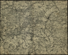
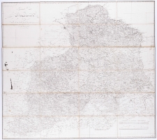
[Mapa Wielkopolski
- Library catalog: Maps
- Creation date : 1900 ca]
- ID: M II 304
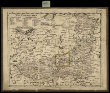
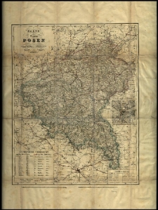
Neu Ostpreussen.
- Library catalog: Maps
- Creation date : 1800 ca].
- ID: M I 040
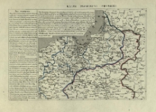
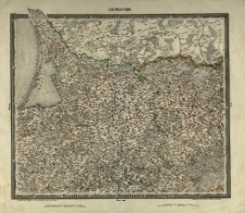
Karta prowincji pruskiej.
- Library catalog: Maps
- Creation date : 1844 ca]
- ID: M II 131
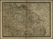
Charte von Gros Polen die Woiwodschaften Posen, Gnesen, Kalisch, Sieradz, Lentschitz, Brsestz, Inowrozlaw, Rawa, Masuren, Plotzk und das Land Dobrsin, nebst einen Theil von Preussen und die benachbarten Lande vorstellend. Entworf. von F. L. Güssefeld.
- Library catalog: Maps
- Creation date : 1791
- ID: M III 188
General Carte von Westgallizien. Nach von dem Kaiserl. Königl. Generalquartiermeisterstaab herausgegebenen Spezial-Carte dieses Landes von demselben entwarfen und gezeichnet. Gestochen von Lucas Benedicti. [Oprac. Hieronim Benedicti].
- Library catalog: Maps
- Creation date : 1809]
- ID: A III 003
[Atlas von Zentraleuropa]. Entworfen und bearbeitet von [J. C.] Woerl, gestochen unter seiner Leitung
- Library catalog: Maps
- Creation date : [1838 ca]
- ID: M III 288
[Atlas von Zentraleuropa]. Entworfen und bearbeitet von [J. C.] Woerl, gestochen unter seiner Leitung
- Library catalog: Maps
- Creation date : [1838 ca]
- ID: M III 288
[Atlas von Zentraleuropa]. Entworfen und bearbeitet von [J. C.] Woerl, gestochen unter seiner Leitung
- Library catalog: Maps
- Creation date : [1838 ca]
- ID: M III 288
[Mapa Polski Środkowej] według karty jen. Chrzanowskiego.
- Library catalog: Maps
- Creation date : 1913]
- ID: M IV 255
[Mapa Polski Środkowej] według karty jen. Chrzanowskiego.

- Library catalog: Maps
- Creation date : [1913]
- ID: M IV 078
[Mapa Polski Środkowej] według karty jen. Chrzanowskiego.
- Library catalog: Maps
- Creation date : 1913]
- ID: M III 284
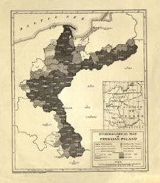
Ethnographical map of prussian Poland. Drawn by O. Kudrewicz and T. Skowroński.
- Library catalog: Maps
- Creation date : 1919]
- ID: M III 232
Chart of the Gulf of Finland from the Late Russian Surveys drown by J. S. Hobbs.
- Library catalog: Maps
- Creation date : 1863
- ID: M IV 319
Atlas nazw geograficznych Słowiańszczyzny Zachodniej.
- Library catalog: Maps
- Creation date : 1990
- ID: A IV 092
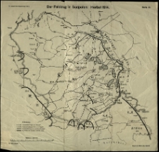
Plany bitew I wojny światowej.
- Library catalog: Maps
- Creation date : [1919]
- ID: M III 715
War Department Weather Map. Signal Service U. S. Army. Division of Telegrams Andreports for the Benefit of Commerce and Agriculture.
- Library catalog: Maps
- Creation date : 1872
- ID: M III 716
[Mapa Polski].
- Library catalog: Maps
- Creation date : 18 w. ca]
- ID: M III 717
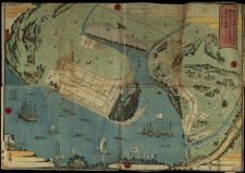
[Mapa portu w Jokohamie] /
- Library catalog: Maps
- Creation date : ca 1859.
- ID: M III 728
[Śląsk.]
- Library catalog: Maps
- Creation date : 1750 ca]
- ID: M IV 083

Viewed records 2581-2600 from 3325