Search Results
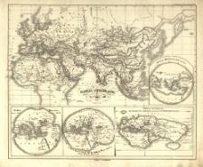
Orbis terrarum veteribus notus.
- Library catalog: Maps
- Creation date : 1837
- ID: M III 153
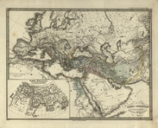
Orbis terrarum notus usque ad Alexandrii Magni tempora.
- Library catalog: Maps
- Creation date : [1837]
- ID: M III 154
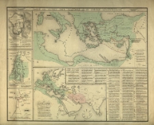
Carte des actes des Apotres et du siècle apostolique.
- Library catalog: Maps
- Creation date : [1900 ca]
- ID: M IV 063
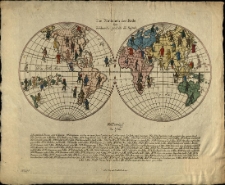
Die Nationen der Erde :
- Library catalog: Maps
- Creation date : [ca 1820].
- ID: M II 014
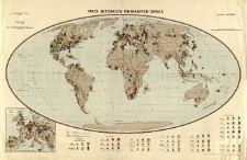
Mapa surowców mineralnych świata.
- Library catalog: Maps
- Creation date : 1956
- ID: M III 293
Tableau orographique et hydrographique du globe [...].

- Library catalog: Maps
- Creation date : [1850 ca]
- ID: M IV 258
Tableau comparatif et figuré de la hauteur des principales montagnes et du cours des principaux fleuves due monde /
- Library catalog: Maps
- Creation date : [ca 1850].
- ID: M IV 043
Map shewing the lines of communication carried on by the steamers of the Peninsular and Oriental Steam Navigation Company with the distances between the various ports.
- Library catalog: Maps
- Creation date : 1874
- ID: M I 077
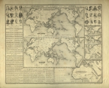
ethnographie en regard de la genèse. [1] Planisphère des races humaines. [2] Planisphère linguistique.
- Library catalog: Maps
- Creation date : [1900 ca]
- ID: M IV 064
Ravensteins Weltkarte. Äquatorial Masstab 1:40 Millionen.
- Library catalog: Maps
- Creation date : 1941
- ID: M IV 259
Dietrich Reimer's Karte vom Ostasiatischen Kriegsschauplatz. Vom Suez-Kanal zum Panama-Kanal.
- Library catalog: Maps
- Creation date : [1842]
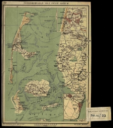
Nordseeinseln Sylt, Föhr, Amrum.
- Library catalog: Maps
- Creation date : [1910 ca]
- ID: M I 033
Projekt kolei żelaznej łączącej Szczawnicę z liniami istniejacemi.
- Library catalog: Maps
- Creation date : 1900
- ID: M II 303
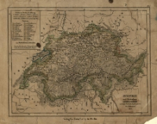
Schweiz und Fürstenthum Lichtenstein nach [...] [Friedrich Wilhelm] Streits. Angaben gez. von W. v. Möllendorf.
- Library catalog: Maps
- Creation date : 1837
- ID: M II 067
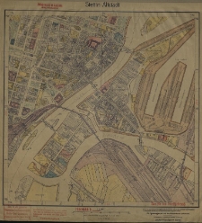
Stettin-Altstadt.
- Library catalog: Maps
- Creation date : 1936
- ID: M III 177
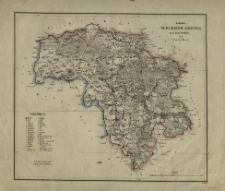
Karte des Schubiner Kreises Regr. Bezk. Bromberg. H. Delius lith.
- Library catalog: Maps
- Creation date : 1839
- ID: M III 017
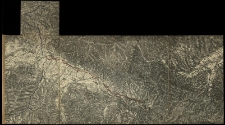
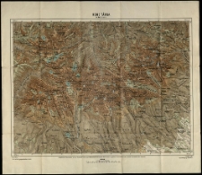
Karte der Hohen Tatra.
- Library catalog: Maps
- Creation date : 1881
- ID: M III 675
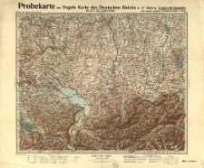
Probekarte aus Vogels Karte des Deutschen Reichs in 27 Blättern. Red. von C. Vogel
- Library catalog: Maps
- Creation date : [1910 ca]
- ID: M III 307
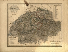
Karte von der Schweiz eingetheilt in zwey und zwanzig Cantone.
- Library catalog: Maps
- Creation date : 1830 ca]
- ID: M II 040
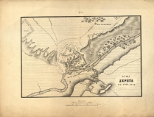
Osada Derpta v' 1704 godu.
- Library catalog: Maps
- Creation date : 1850 ca]
- ID: M II 080

Viewed records 2661-2680 from 3325