Search Results
Neue Post- und Reisekarte von Deutschland und einem Theile der angrenzenden Länder nebst genauer Bezeichnung aller bis jetzt eröffneten Eisenbahnen :
- Library catalog: Maps
- Creation date : 1864
- ID: A I 013
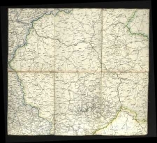
Post- und Eisenbahn-Reisekarte von Central-Europa nach F. Handtke's Post- u. Reisekarte reducirt /

- Library catalog: Maps
- Creation date : 1863
- ID: A I 110
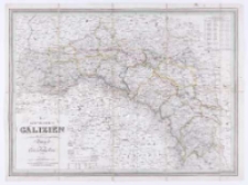
Koenigreich Galizien mit den nivellirten und projectirten
- Library catalog: Maps
- Creation date : 1841
- ID: A I 037/2
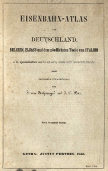
Eisenbahn-Atlas von Deutschland, Belgien, Elsass und dem nördlichsten Theile von Italien in 15 Specialkarten auf 12 Blättern, nebst einer Uebersichtskarte :
- Library catalog: Maps
- Creation date : 1850
- ID: A II 031
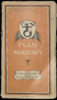
Plan Warszawy /
- Library catalog: Maps
- Creation date : [1930 ca]
- ID: A II 076
Atlas statystyczny Polski /
- Library catalog: Maps
- Creation date : 1925
- ID: A IV 051/2
Smith's illustrated astronomy, designed for the use of the public or common schools in the United States :
- Library catalog: Maps
- Creation date : 1854
- ID: A III 093
System of Geography for the Use of Schools :
- Library catalog: Maps
- Creation date : 1852
- ID: A III 096
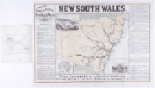
New South Wales :
- Library catalog: Maps
- Creation date : 1884
- ID: A III 099
Diagrams illustrating the sciences of astronomy and geography /
- Library catalog: Maps
- Creation date : 1850
- ID: A III 100
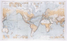
Chart of the world on Mercators projection /
- Library catalog: Maps
- Creation date : 1875
- ID: A II 040
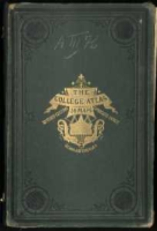
The college atlas, for schools and families; 36 maps, printed in colours with a complete index /
- Library catalog: Maps
- Creation date : [1875 ca]
- ID: A III 076
Maps to accompany annual report of the Departament of Mines New South Wales for the year 1879 /
- Library catalog: Maps
- Creation date : 1880
- ID: A III 091
Diagram exhibiting a view of nature in all climates, from the equator to the arctic circle, illustrating the astronomical and physical phenomena, and characteristic scenery of the different regions, with the principal forms of animal and vegetable life:
- Library catalog: Maps
- Creation date : 1852
- ID: A III 098
atlas geograficzny zastosowany do ćwiczeń kartograficznych /
- Library catalog: Maps
- Creation date : 1873
- ID: A II 062
Polands possible contribution to future air transport /
- Library catalog: Maps
- Creation date : 1944
- ID: A III 088
Wzory rysowania mapp roznego rodzaju :
- Library catalog: Maps
- Author: Kolberg, Juliusz geodeta, kartograf ; (1776-1831)
- Creation date : 1825
- ID: A II 073
Teorya rysowania gór podług Lehmana z Dzieła przez F. A. W. Netto Dr. Fil. Prof. Szko. Woysk; w Berlinie w niemieckim języku wydanego /
- Library catalog: Maps
- Author: Kolberg, Juliusz geodeta, kartograf ; (1776-1831)
- Creation date : 1825
- ID: A II 074
Wzory rysowania mapp i planów /
- Library catalog: Maps
- Author: Kolberg, Wilhelm kartograf, inżynier dróg i mostów ; (1807-1877)
- Creation date : 1837
- ID: A II 085
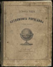
Budowa nieba czyli astronomia popularna figurami objaśniona /
- Library catalog: Maps
- Creation date : 1857
- ID: A III 078
Viewed records 2941-2960 from 3325