Search Results
Teorya rysowania gór podług Lehmana z Dzieła przez F. A. W. Netto Dr. Fil. Prof. Szko. Woysk; w Berlinie w niemieckim języku wydanego /

- Library catalog: Maps
- Author: Kolberg, Juliusz geodeta, kartograf ; (1776-1831)
- Creation date : 1825
- ID: A II 074
Wzory rysowania mapp i planów /
- Library catalog: Maps
- Author: Kolberg, Wilhelm kartograf, inżynier dróg i mostów ; (1807-1877)
- Creation date : 1837
- ID: A II 085
Budowa nieba czyli astronomia popularna figurami objaśniona /
- Library catalog: Maps
- Creation date : 1857
- ID: A III 078
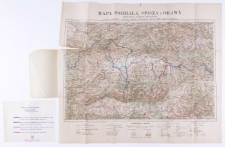
Mapa turystyczna Podhala, Spisza i Orawy /
- Library catalog: Maps
- Creation date : 1920
- ID: A II 096
Plan niwellacyiny :
- Library catalog: Maps
- Creation date : 1830
- ID: A II 101
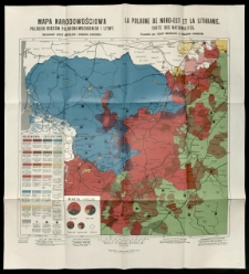
Mapa narodowościowa polskich kresów północno-wschodnich i Litwy =
- Library catalog: Maps
- Creation date : 1922
- ID: A II 104
Mappa teatru wojny w r. 1831 /
- Library catalog: Maps
- Creation date : [1881]
- ID: A II 125
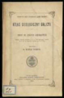
Atlas geologiczny Galicyi :
- Library catalog: Maps
- Creation date : 1903.
- ID: A II 126
Mapa Królestwa Polskiego /
- Library catalog: Maps
- Creation date : 1900
- ID: A II 132
Plan m. st. Warszawy /
- Library catalog: Maps
- Creation date : 1927 ca
- ID: A II 198
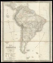
Süd America /
- Library catalog: Maps
- Creation date : 1829
- ID: A II 082
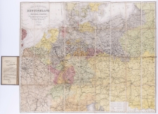
Post-Reise- und Eisenbahn-Karte von Deutschland, der Schweitz, den Niederlanden und Belgien, nebst Theilen der angrenzenden Länder bis Kopenhagen, Yarmouth, Dover, Rouen, Paris, Lyon, Turin, Ferrara, Venedig, Pesth, Kaschau, Warschau, Tauroggen :
- Library catalog: Maps
- Creation date : 1877
- ID: A II 151
General-Karte von Westlichen Russland nebst Preussen, Posen und Galizien:
- Library catalog: Maps
- Creation date : [1850 ca]
- ID: A III 036
Nord America /
- Library catalog: Maps
- Creation date : 1830
- ID: A II 083
Atlas nazw geograficznych Słowiańszczyzny Zachodniej /
- Library catalog: Maps
- Creation date : 1934
- ID: A IV 047/1
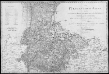
Fürstenthum Jauer, oder der Jauersche, Hirschbergsche und Löwenberg-Bunzlausche Kreis, welcher leztere in zwey Districte den Bunzlauer und Löwenberger getheilt wird /
- Library catalog: Maps
- Creation date : 1813
- ID: A III 015
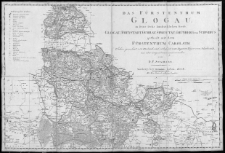
Fürstenthum Glogau, in seine sechs landräthlichen Kreise, Glogau, Freystadt, Gugrau, Sprottau, Grünberg und Schwibus zetheilt, mit dem Fürstenthum Carolath /
- Library catalog: Maps
- Creation date : 1813
- ID: A III 016
Fürstenthum Oppeln, oder der Oppelnsche, Ealkenbergsche, Lublinitzsche, Rosenbergsche, Gros Strehlitzsche, Coselsche, Toster und Neustädtsche, Kreis, nebst der freÿen Standesherrschaft Beuthen oder dem Beuthener Kreise /
- Library catalog: Maps
- Creation date : 1813
- ID: A III 017
Amerikanische Continent. Topographische und Eisenbahn-Karte der Vereinigten Staaten, Britischen Besitzungen, Westindien, Mexiko und Central-Amerika /
- Library catalog: Maps
- Creation date : 1864
- ID: A III 029
Hipologische Karte von Osterreich /
- Library catalog: Maps
- Creation date : 1874
- ID: A III 051

Viewed records 1441-1460 from 3325