Search Results
Magyaroszag.

- Library catalog: Maps
- Creation date : 1962?]
- ID: M I 153
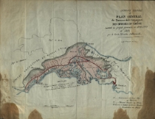
Avant projekt et Plan General des Travaux de la Campagnie des Bouches du Rhone suivant les projets en 1846-1849 et 1852 par Wacław Jabłonowski.
- Library catalog: Maps
- Creation date : 1852 ca]
- ID: M III 335
Israel Boundaries and Cease-Fire Lines.
- Library catalog: Maps
- Creation date : 1991
- ID: M II 294
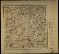
Ost- und West-Preussen. Nach den besten Quellen entworf. und geziechnet vom Radefeld.
- Library catalog: Maps
- Creation date : 1852 ca]
- ID: M II 236
Mapa powiatu Przysucha. Podział administracyjny wg stanu z dn. 1 I 1957 r.
- Library catalog: Maps
- Creation date : 1957
- ID: M IV 192
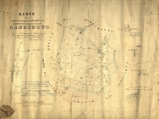
Karte von dem im Regierungbezirk Posen, Kreis Fraustadt, belegen Vorwerk Raduchowo. Copirt im Juli 1862 nach der Behufs Grundsteuer Regulirung aufgenommen Original Gemarkungskarte durch J. Bessig königl. Regs. Geometer.
- Library catalog: Maps
- Creation date : 1862
- ID: M III 564
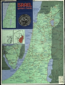
Israel gestern heute
- Library catalog: Maps
- Creation date : 1983
- ID: M III 767
topografia di Roma di Giobatta Noli della maggiore in questa minor tavola dal medesimo ridota eda [...] incisa.
- Library catalog: Maps
- Creation date : 1773
- ID: M III 344
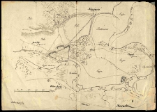
Plan bitwy pid Sałychoju 28 Czerwinnia 1863.
- Library catalog: Maps
- Creation date : ca 1863]
- ID: M I 080
Das Russische Kriegsgebiet zwischen Ostsee und Schwarzem Meer.
- Library catalog: Maps
- Creation date : 1914-1918 ?
- ID: M IV 212
Das europäische Russland mit Verkehrsnetz. /
- Library catalog: Maps
- Creation date : 1941
- ID: M III 543
Russland. Mit einem Sonderkärtchen: Nord und Mittelasien.
- Library catalog: Maps
- Creation date : 1941
- ID: M III 542
Rustoff. Blatt Nr. L-37-V-West. Sonderausgabe II. 1941. Nur fur den Dienstgebrauch.
- Library catalog: Maps
- Creation date : 1941
- ID: M IV 097
[Mapa okolic Serocka z czasów powstania listopadowego.]
- Library catalog: Maps
- Creation date : 1831 21.05. przed
- ID: M I 087
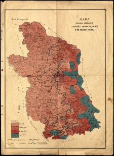
Mapa gęstości osiedlenia ludności prawosławnej w guberni siedleckiej i lubelskiej.
- Library catalog: Maps
- ID: M I 134
Provinz Schlesien.
- Library catalog: Maps
- Creation date : 1847
- ID: M II 235
Mapa Górnego Śląska :
- Library catalog: Maps
- Creation date : 1904.
- ID: M II 270
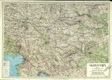
Slovenija.
- Library catalog: Maps
- Creation date : [1970 ca]
- ID: M III 590
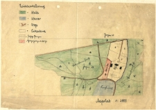
[Plan parku i zabudowań dworskich.]
- Library catalog: Maps
- Creation date : [1942 ca]
- ID: M I 138
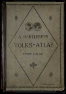
Volks - Atlas enthalted 86 Hauptkarten und 84 Nebenkarten in einhundertf:unfundzwanzig Kartenseiten, mit erl`:auterndem Text und vollständigem alphabetischen Register. - Fünfte vollkomen umgearbeitete und erneuerte Auflage.
- Library catalog: Maps
- Creation date : [1917 przed]
- ID: A IV 088
Viewed records 1461-1480 from 3325