Search Results
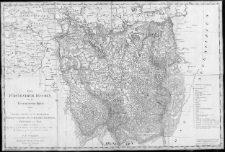
Fürstenthum Teschen, oder der Teschensche Kreis, enthaltend das Fürstenthum Bielitz und die Minderherrschaften Friedeck, Oderberg, Deutschleuthen, Reichwalde, Freystadt und Roy /
- Library catalog: Maps
- Creation date : 1813
- ID: A III 023
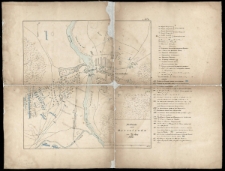
Plan okolic Warszawy /
- Library catalog: Maps
- Creation date : 1820
- ID: A III 026
Mappa dróg żelaznych: warszawsko-wiedeńskiej i krakowskiej z okolicami na szerokość 8 do 9 mil /
- Library catalog: Maps
- Creation date : [1853]
- ID: A III 031
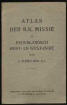
Atlas der R. K. missie in Nederlandsch Oost- en West-Indië /
- Library catalog: Maps
- Creation date : 1928
- ID: A III 033
Verkehrs-Karte von Österreich-Ungarn :
- Library catalog: Maps
- Creation date : 1910
- ID: A III 034
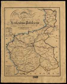
Mappa Królestwa Polskiego z nowym podziałem /
- Library catalog: Maps
- Creation date : 1870
- ID: A III 043
war they have undertaken in behalf of Turkey and the just right of nations, this map of the present seat of war, originally founded, and constructed, on the basis of remarkable Russian materials by the staff of the Austrian quartermaster-general at the command of field marshall prince Schwarzenberg, has been exactly reproduced (200 copies in ten days) /
- Library catalog: Maps
- Creation date : 1854
- ID: A IV 044
Diercke Schulatlas für höhere Lehranstalten Grosse Ausgabe /
- Library catalog: Maps
- Creation date : 1917.
- ID: A III 151
Atlas historyczny Polski /

- Library catalog: Maps
- Creation date : 1928
- ID: A III 157
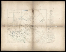
Schlacht von Wawre am 7/19 Febr. 1831.
- Library catalog: Maps
- Creation date : 1832 ca]
- ID: A III 122
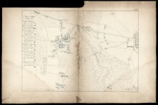
Schlacht bei Bialolenka am 12/24 Februar 1831.
- Library catalog: Maps
- Creation date : 1832 ca]
- ID: A III 123
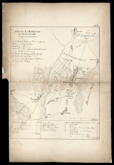
Schlacht von Grochow am 13/25 Februar 1831.
- Library catalog: Maps
- Creation date : 1832 ca]
- ID: A III 124
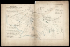
Treffen bei Iganie am 29 März - 10 April 1831.
- Library catalog: Maps
- Creation date : 1832 ca]
- ID: A III 125
Gefecht bei Nur [...] am 10\22 Mai 1831.
- Library catalog: Maps
- Creation date : 1832 ca]
- ID: A III 126
Schlacht von Ostrolenka am 14/26 May 1831.
- Library catalog: Maps
- Creation date : 1832 ca]
- ID: A III 127
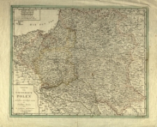
Karta poczt Królestwa Polskiego [...].
- Library catalog: Maps
- Creation date : 1827
- ID: M I 045
Karta pocztowa Królestwa Polskiego /
- Library catalog: Maps
- Creation date : 1827.
- ID: M III 066
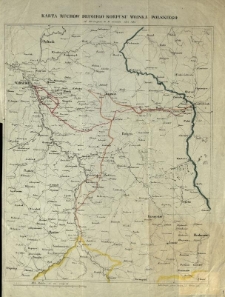
Karta ruchów drugiego korpusu Wojska Polskiego od 23 sierpnia do 16 września 1831 r.
- Library catalog: Maps
- Creation date : 1850 ca]
- ID: M II 153
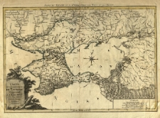
Post Karte von der Halbinsel Taurien oder Krim 1788
- Library catalog: Maps
- Creation date : 1788
- ID: M II 026
Carte du gouvernement de Tauride comprenant La Krimee et les pays voisins par les freres Lotter. Partie du theatre de la guerre entre les Turcs et les Russes.
- Library catalog: Maps
- Creation date : [1770 ca]
- ID: M III 136

Viewed records 1481-1500 from 3325