Search Results
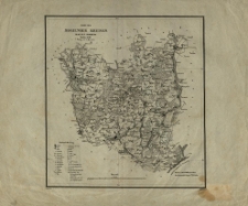
Województwo lubelskie.

- Library catalog: Maps
- Creation date : 1955
- ID: A III 083
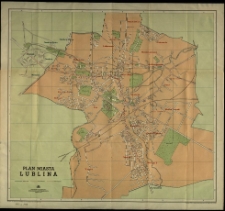
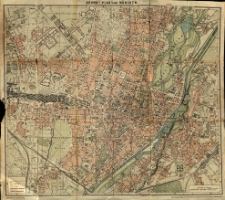
Plan miasta Lublina.
- Library catalog: Maps
- Creation date : 1957
- ID: M III 636
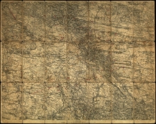
Ziemia Lubuska. Wielkopolska zachodnia :
- Library catalog: Maps
- Creation date : 1947.
- ID: A I 081
Pojezierze lubuskie. [...]
- Library catalog: Maps
- Creation date : 1985
- ID: M III 644
Plan król. stoł. miasta Lwowa.
- Library catalog: Maps
- Creation date : 1903
- ID: M I 025
Umgebungskarte von Lemberg.
- Library catalog: Maps
- Creation date : [1910 ca]
- ID: M III 622
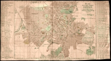
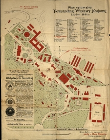
Plan sytuacyjny Powszechnej Wystawy Krajowej, Lwów 1894 r.
- Library catalog: Maps
- Creation date : 1894
- ID: M III 214
Plan bitwy [...] pod Maciejowicami [...] stoczonej dnia 10 października 1794 roku. Kopia z oryginału ówczesnego przez Floryana Dembowskiego.
- Library catalog: Maps
- Creation date : 1861
- ID: M II 104
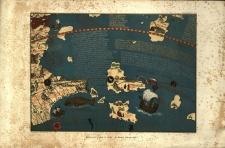
Madagascar d'aprés le globe de Martin Beheim (1492) /
- Library catalog: Maps
- Creation date : [ca 1892].
- ID: M II 021
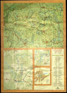
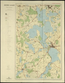
Jezioro Mamry. Mapa turystyczna.
- Library catalog: Maps
- Creation date : 1957
- ID: M III 791
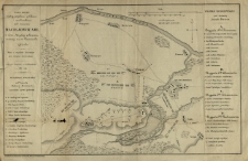
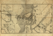
Quadrilatère strategique. Plan topographique de la bataille de Solferino. Details des quatre places fortes.
- Library catalog: Maps
- Creation date : 1859
- ID: M IV 019
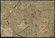
Milano.
- Library catalog: Maps
- Creation date : 1910 ca]
- ID: M I 020
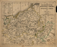
Grossherzogthümer Meclenburg Schwerin und Meclenburg Strelitz, entworf. von F. W. Streit u. gez. von [...] Arno Streit.
- Library catalog: Maps
- Creation date : [1837]
- ID: M II 059
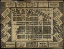
[...] Map of the city of Melbourne.
- Library catalog: Maps
- Creation date : 1879
- ID: M III 783
Plan der Stadt Menin und ihrer Befestigung in April 1794. J. F. W. Schleuen sc.
- Library catalog: Maps
- Creation date : 1802
- ID: M III 203
Karte des Mogilnoer Kreises Regr. Bez. Bromberg. Nowack gez. H. Delius grav.
- Library catalog: Maps
- Creation date : 1839
- ID: M III 013
Brunn's Plan von München. Gez. von Oscar Brunn.
- Library catalog: Maps
- Creation date : [1910 ca]
- ID: M III 299
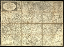
Moraviae nova et omnes priores accuratissima delineatio auctore I. A. Comenio [Jan Amos Komensky]. Noviter edita a Nicolao Iohannide Piscatore. 1645.
- Library catalog: Maps
- Creation date : 1892
- ID: M III 097
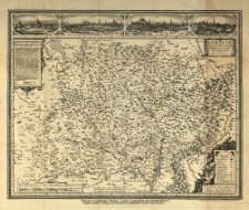
Karte des Markgrafthum Maähren. Entworfen nach jener von C. Müller, und nach den besten und neusten Hülfsquellen berichtiget von I.E.S. Gestochen von T. Reisser.
- Library catalog: Maps
- Creation date : 1804
- ID: M III 624
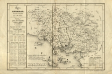
Carte du Morbihan dressee au 500 000-e par N. Bassac [...].
- Library catalog: Maps
- Creation date : [1900 ca]
- ID: M II 092
Viewed records 1521-1540 from 3325