Search Results
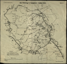
Plany bitew I wojny światowej.
- Library catalog: Maps
- Creation date : [1919]
- ID: M III 715
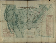
War Department Weather Map. Signal Service U. S. Army. Division of Telegrams Andreports for the Benefit of Commerce and Agriculture.
- Library catalog: Maps
- Creation date : 1872
- ID: M III 716
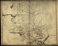
[Mapa Polski].
- Library catalog: Maps
- Creation date : 18 w. ca]
- ID: M III 717
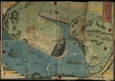
[Mapa portu w Jokohamie] /
- Library catalog: Maps
- Creation date : ca 1859.
- ID: M III 728
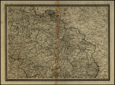
[Śląsk.]
- Library catalog: Maps
- Creation date : 1750 ca]
- ID: M IV 083
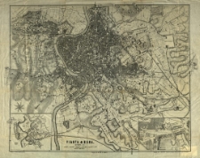
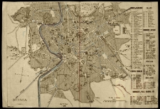
Pianta di Roma. Disegnata da J. Heyberger.
- Library catalog: Maps
- Creation date : 1867
- ID: M III 207
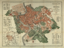
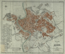
Pianta della citta di Roma.
- Library catalog: Maps
- Creation date : 1885
- ID: M III 028
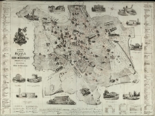
Pianta di Roma e suoi monumenti publicata per [...] Carlo Marre.
- Library catalog: Maps
- Creation date : [1900 ca]
- ID: M III 305
Plan de Rome. L. Thuillier del-t.
- Library catalog: Maps
- Creation date : [1900 ca]
- ID: M III 197
Roma.
- Library catalog: Maps
- Creation date : 1910 ca]
- ID: M I 023
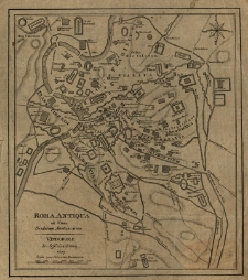
Roma antiqua ad usum scholarum austriacarum.
- Library catalog: Maps
- Creation date : 1807
- ID: M II 152
Orbis Romani pars orientalis [...].
- Library catalog: Maps
- Creation date : 1782
- ID: M III 095
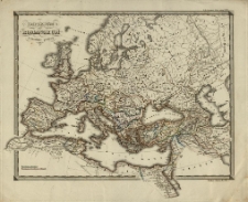
Imperium Romanorum post divisionem in Occidentale et Orientale. [Karl Spruner von Merz] Edler sc.
- Library catalog: Maps
- Creation date : [1837]
- ID: M III 157
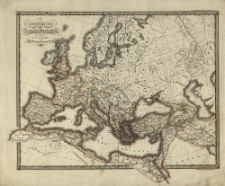
Imperium Romanorum latissime patens. [Karl Spruner von Merz] Edler sc.
- Library catalog: Maps
- Creation date : 1837
- ID: M III 156
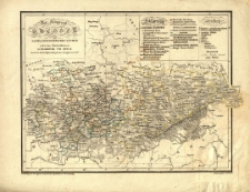
Königreich Sachsen, die sachs. ernestinischen Länder nebst den Furstenthümern Schwarzburg und Reuss [...] für den Schulgebrauch entworfen.
- Library catalog: Maps
- Creation date : [1830 ca]
- ID: M II 036
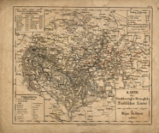
Karte der Grossherzogl. u. Herzoglich. Sächsichen Länder entw. u. gez. nach Angabe des [F. W.] Streit von Walter.
- Library catalog: Maps
- Creation date : 1835
- ID: M II 056
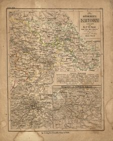
Das Königreich Sachsen /
- Library catalog: Maps
- Creation date : [ca 1837].
- ID: M II 052
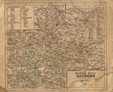
Die preussische Provinz Sachsen /
- Library catalog: Maps
- Creation date : 1834.
- ID: M II 055
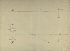
Underground survey of mines Sand hurst - Hustler's line of Reef. Arthur F. Walker. Surveyed under the direction of Thomas Couchman.
- Library catalog: Maps
- Creation date : 1877
- ID: M III 121
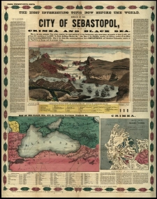
Mirror of the city of Sebastopol and map of Crimea and Black Sea.
- Library catalog: Maps
- Creation date : 1854
- ID: M IV 023

Viewed records 1781-1800 from 3325