Search Results
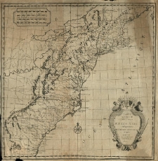
Carte generale des Treize Etats Unis Independants de l'Amerique Septetrionale d'après [Rigobert de] Bonne [...].
- Library catalog: Maps
- Creation date : 1780 ca]
- ID: M III 306
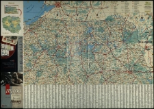
Tracks of Areas of Low Preasure.

- Library catalog: Maps
- Creation date : 1885]
- ID: M II 285
Plan der Stadt Posen.
- Library catalog: Maps
- Creation date : 2003]
- ID: Cz. 4781
Expedition of Hannibal General of the Karthaginiani according to Livÿ et Cornelius Nepos.
- Library catalog: Maps
- Creation date : 19 w. ca]
- ID: S 52
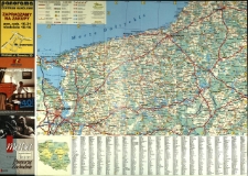
Mazury. Mapa "Gazety Wyborczej".
- Library catalog: Maps
- Creation date : 2000
- ID: M III 698
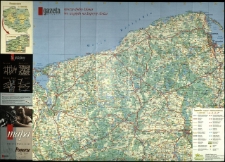
Pomorze Zachodnie. Mapa "Gazety Wyborczej".
- Library catalog: Maps
- Creation date : 2001
- ID: M III 701
Chart of the Coasts of Great Britain, Ireland, France, Spain. Portugal. Showing the Whole Navigation from the Feroe and Orkney Isles to Gibraltar , Barcelona, Algiers. Revised and Materialty Improved from the Latest English, French and Spanish Surveys by J. S. Hobbs.
- Library catalog: Maps
- Creation date : 1863
- ID: M IV 318
Plan miasta Jasła.
- Library catalog: Maps
- Creation date : 1980 ca
- ID: M II 284
Pomorze. Mapa "Gazety Wyborczej".
- Library catalog: Maps
- Creation date : 2001
- ID: M III 704
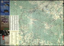
Bieszczady. Mapa "Gazety Wyborczej".
- Library catalog: Maps
- Creation date : 2001
- ID: M III 705
Polska Rzeczpospolita Ludowa. Mapa fizyczna.
- Library catalog: Maps
- Creation date : [1970]
- ID: M I 144
Mapa morfogenetyczna Dolnego Powiśla i terenów przylegających (obszar ostatniego zlodowacenia).
- Library catalog: Maps
- Creation date : [1968 ca]
- ID: M III 524
Karkonosze polskie i czeskie. Mapa "Gazety Wyborczej".
- Library catalog: Maps
- Creation date : 2002
- ID: M III 707
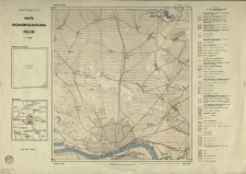
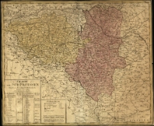
Charte von Süd Preussen.
- Library catalog: Maps
- Creation date : 1794
- ID: M III 189
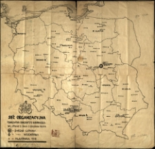
Sieć organizacyjna Towarzystwa Uniwersytetu Robotniczego wg.[!] stanu z dnia 1 grudnia 1946 r.
- Library catalog: Maps
- Creation date : 1946
- ID: M III 710
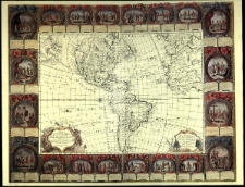
Carte d'Amérique, divisée en ses principaux pays :
- Library catalog: Maps
- Creation date : 1992.
- ID: M III 712
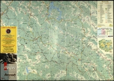
Województwo pomorskie. Mapa administracyjno-turystyczna. Red. Barbara Kawałko, Karol Kawałko, oprac. kart. Jan Majewski i Jarosław Bartczak, oprac. tekstu Wacław Nowicki, oprac. graf. Tadeusz Wadas, Michał Rulewicz.
- Library catalog: Maps
- Creation date : 2001
- ID: M IV 298
Great Geographical Atlas.
- Library catalog: Maps
- ID: A IV 087
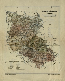
Szepes varmegye terkepe. Kogutowicz M. Megyei terkepek.
- Library catalog: Maps
- Creation date : 1900 ca]
- ID: M II 160
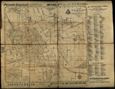
Plan m[iasta] Warszawy z numeracya domów.
- Library catalog: Maps
- Creation date : 1904
- ID: M IV 323
Viewed records 1881-1900 from 3325