Search Results
- Go to the collection
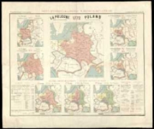
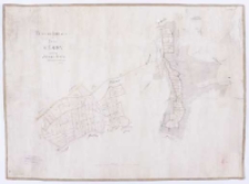
Carte historiques de la Pologne :
- Library catalog: Kartografia
- Data wydania: 1914.
- Sygnatura: M III 261
- Go to the collection
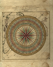
Tabula Anemographica seu Charta Nautica vulgo Compass Charte qua Mundi Quatuor Plagae et Ventorum Nomina Septem Linguis Graeca scilicet, Latina, Italica, Hispanica, Gallica, Hollandica et Germanica repraesentatur /
- Library catalog: Kartografia
- Data wydania: 1750 ca
- Sygnatura: M III 321
- Go to the collection
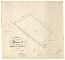
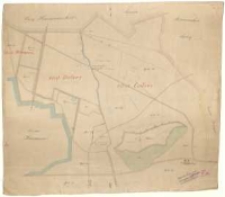
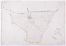
Mappa części odciętej koleją od rewiru Drapałka I majętności kórnickiej /
- Library catalog: Kartografia
- Data wydania: 1879
- Sygnatura: M III 377
- Go to the collection
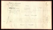
Plan II von der Abfindungsflaeche für Wald Berechtigung der baeuerlichen Wirthe zu Dembiec <Kurnik> Kreis Schrimm /
- Library catalog: Kartografia
- Data wydania: 1860
- Sygnatura: M III 385
- Go to the collection
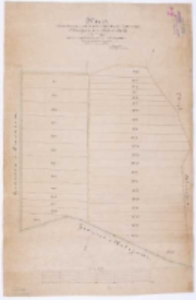
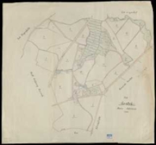
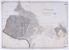
Czołowo i Bielawy obręby leśne około r. 1882.
- Library catalog: Kartografia
- Data wydania: 1882
- Sygnatura: M III 386
- Go to the collection
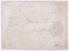
Karta rozparcelowania gruntu powstałego z wyrębu lasu w rewirze Błażejewa dóbr Kórnickich zawierająca zarazem uregulowanie granicy z Kalejami /
- Library catalog: Kartografia
- Data wydania: 1886
- Sygnatura: M III 387
- Go to the collection
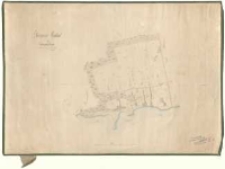
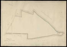
Blazejewer Hauland im Schrimmer Kreise /
- Library catalog: Kartografia
- Data wydania: 1834
- Sygnatura: M III 388
- Go to the collection
Abfindungs Plan für die Gemeinde Błażeiewo Dorf Kreis Schrimm. Nach der Charte des Unterzeichneten vom Jahre 1847 /
- Library catalog: Kartografia
- Data wydania: 1855
- Sygnatura: M III 391
- Go to the collection
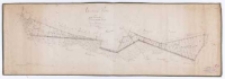
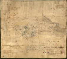
Dworzisko mit den Weide Abfindungs Ländereien im Schrimmer Kreise. Nach der vorhandenen Charte vom Jahre 1830 /
- Library catalog: Kartografia
- Data wydania: 1841
- Sygnatura: M III 392
- Go to the collection
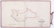
Dworzyska :
- Library catalog: Kartografia
- Data wydania: 1896
- Sygnatura: M III 393
- Go to the collection
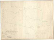
Plan von dem Vorwerke Dworzysko Kreis Schrimm /
- Library catalog: Kartografia
- Data wydania: 1873
- Sygnatura: M III 394
- Go to the collection
Regierungs Bezirk: Posen, Kreis: Schrimm. Gemarkung: Dziećmierowo Gut No. 85 /
- Library catalog: Kartografia
- Data wydania: 1865
- Sygnatura: M III 395
- Go to the collection
Wiesenterrain zum dorfe Czmoń gehörig Schrimmer Kreises /
- Library catalog: Kartografia
- Data wydania: 1834
- Sygnatura: M III 397
- Go to the collection
Gut Gondek Kreis Schrimm.
- Library catalog: Kartografia
- Data wydania: 1939
- Sygnatura: M III 402
- Go to the collection
Brouillon Karte von dem im Szrimschen Kreise belegenen adelichen Guthe Gądki /
- Library catalog: Kartografia
- Data wydania: 1821
- Sygnatura: M III 404
- Go to the collection
Karte von Dorfe Gądki im Schrimmer Kreise belegen /
- Library catalog: Kartografia
- Data wydania: 1833
- Sygnatura: M III 444
- Go to the collection
Mappa gruntów kupionych od p. Franciszka Moderskiego.
- Library catalog: Kartografia
- Data wydania: 19 w.
- Sygnatura: M III 725
- Go to the collection
Situationsplan des zum Korniker Walde gehörigen Czolower Forstreviers /
- Library catalog: Kartografia
- Data wydania: 1801
- Sygnatura: M IV 108
- Go to the collection
Charte von Dębiec Schrimer Kreises /
- Library catalog: Kartografia
- Data wydania: 1860
- Sygnatura: M IV 109
- Go to the collection
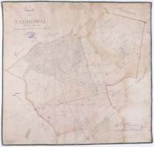
Karte von Bagrowo Kreis Schroda angefertiget 1840 /
- Library catalog: Kartografia
- Data wydania: 1840
- Sygnatura: M IV 110

Viewed records 41-60 from 154